
{
Practical astronomy
|
Astronomy
|
The Moon
|
The physical Moon
|
The Lunar 100
}
Lunar #96: Leibnitz mountains
The Leibnitz mountains are a difficult object to verify its observations. The name is not official and the crater Leibnitz is completely out of our view on the far side of the Moon. We have have only Wood's brief description "rim of the South Pole-Aitken basin". He lists the position as +30°,−85° and without size. In his notes the mountain range appears to lie on the lunar limb beyond the area between the craters Moretus and Simpelius, which would, however, imply a longitude range between −5° and +15°.
The Atlas virtuel de la Lune by itself is not much help. It does not label this feature, nor the South Pole-Aitken basin. The basin is a huge depression that is not easy to recognise, except in altitude data.
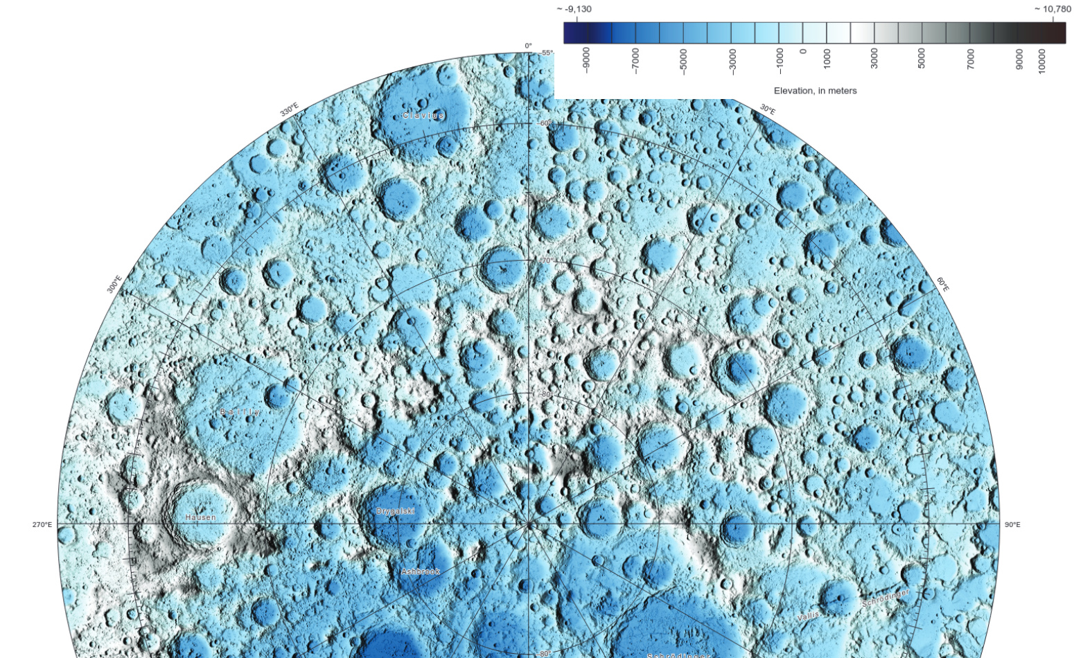
We can use the Lunar Reconnaissance Orbiter laser altimeter map (USGS 2015a) for a clearer view of the basin. The map shows a large area of moderately low altitude on the northern and Earth-facing side of the moon. We recognise this area as the dark and nearly craterless maria. Rather deeper is a large area on the southern and far side of the Moon, but this has almost as many craters as our familiar highland regions. The northern rim, on the far side of the Moon, is relatively well defined. The southern rim is less pronounced, but runs through the south pole of the Moon. This is where Wood places the Leibnitz mountains.
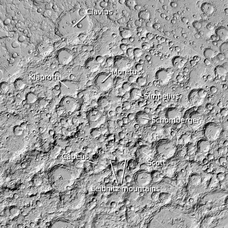
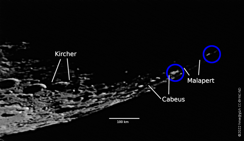
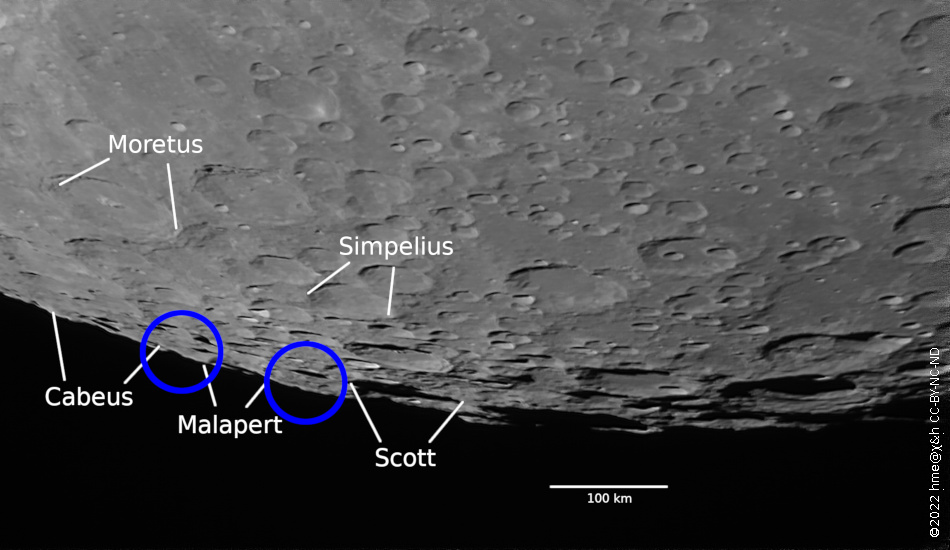
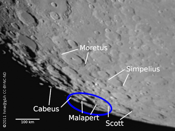
At Wood's position +30°,−85° is a very high area of 80 or 100 km in diameter. One may also consider a smaller area of similar height at small western (negative) longitude. As seen from Earth, this lies in front of the crater Haworth; the crater can probably never be seen from Earth on account of the mountain. In our view might instead be the crater Malapert. Either side of this pair of mountains lie the craters Cabeus and Scott. The mountain peaks are at +6.5 km altitude while the neighbouring crater floors are around −5 km.
Wood's notes recommend day 7 of the lunation (First Quarter) for observation. I suggest that the phase is less relevant, as it does not give an accurate indication of the illumination of the south pole. Favourable libration in latitude is more important.
Refer to Wood's list (2004a and 2012a) and to his notes (cf. Hardwick 2013a). Compare your observation with the Atlas virtuel de la Lune (Chevalley and Legrand 2012a). In this atlas, at high resolution, in general, consider a photographic texture like the LRO WAC mosaic as well as the synthesised topography of the LOLA Kaguya Shade texture. For regions near the lunar limb, changing from the foreshortened Earthlings' perspective to the vertical view down on the Moon can be instructive.
Images:
- Altitude map of the south polar region of the Moon (USGS 2015a). The direction to the Earth is up.
- Annotated screenshot from Atlas virtuel de la Lune using the shaded relief texture. The direction to the Earth is up.
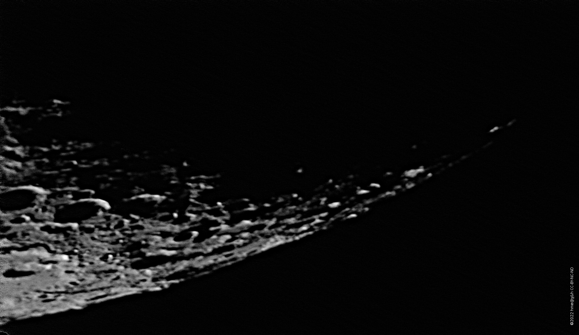
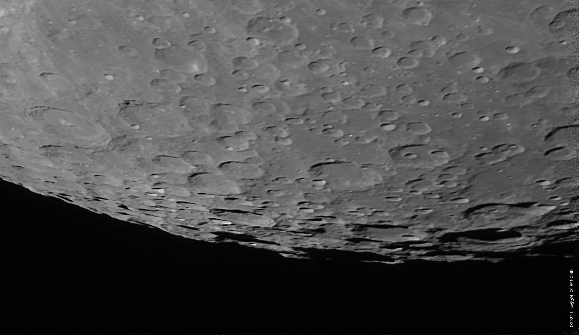
- The southern tip of the lunar crescent on 2022-11-19, stacked from 700 video frames taken with a Schmidt-Cassegrain reflector of D = 200 mm and f = 3500 mm and Canon EOS 600Dα camera. Wavelet sharpening. Libration in latitude was −5.2°; the phase was −25% (waning crescent).
- Dto. with annotation, scale, and the two mountain areas marked in blue.
- The south pole on 2022-10-12, stacked from 898 video frames taken with a Schmidt-Cassegrain reflector of D = 200 mm and f = 3500 mm and Canon EOS 600Dα camera. Wavelet sharpening. Libration in latitude was +0.1°; the phase was −94% (just after Full Moon).
- Dto. with annotation, scale, and the two mountain areas marked in blue.
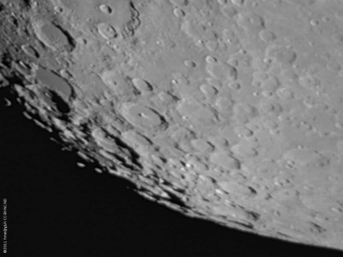
- The south pole on 2011-11-06, stacked from 24 video frames taken with a Schmidt-Cassegrain reflector of D = 200 mm and f = 2000 mm and Logitech C300 SXGA webcam. Unsharp mask. Libration in latitude was −5.9°; the phase was +86% (days before Full Moon).
- Dto. with annotation, scale, and the mountain areas marked in blue.
